Leveling tools and automatic digital levels
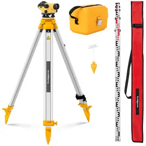

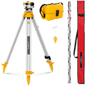
Automatic Level - with tripod and level staff - 32x magnification - 38 mm lens - deviation 1 mm - magnetic compensator
Lowest price in the 30 days before the discount: €239.00

Automatic Level - with tripod and level staff - 32x magnification - 40 mm lens - deviation 1 mm - air damped compensator
Lowest price in the 30 days before the discount: €229.00

Automatic Level - with tripod and level staff - 28x magnification - 36 mm lens - deviation 1.5 mm - magnetic compensator
Lowest price in the 30 days before the discount: €219.00
Automatic Level - with tripod and level staff - 24x magnification - 36 mm lens - deviation 2 mm - air damped compensator
Lowest price in the 30 days before the discount: €249.00
- First
- 1
- Last
Get inspired with expondo blog


Our range of levelling tools
The levelling tool is a professional measuring instrument for determining height differences and height horizontals. Levelling tools are indispensable, especially in the construction industry, for land surveys and expert opinions – for example, for levelling surfaces, precisely aligning machines or planning the slope of watercourses. In our extensive range of environmental measurement technology you can find all utensils and tools for a precise measuring process!
In addition to the actual measuring instrument, a number of other tools are required to carry out the individual work steps professionally: Adjustable tripods can be used to position the measuring instrument at an optimum height, while special levelling staffs can serve as an exact scale during the measuring process. With the high-quality measurement technology from our product selection, you are optimally equipped for any type of terrain measurement.
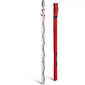
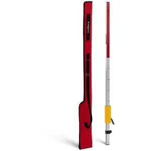
Levelling staffs
Levelling staffs are practical and easy-to-use tools for measuring heights and slopes. When using professional levelling equipment, these rods can serve as a precise scale. They have different scales for coarse as well as particularly fine measurements. Due to the generous measuring range, even large differences in height can be easily read and marked – making the measuring process extremely convenient.
The slats are made of high-quality materials that convince with robustness as well as with lightness. In addition, levelling staffs are usually extendable and offer a particularly extensive measuring range. If laser technology is used for the measurement, deviations of the laser beam can be recorded with a clear marking. Professional levelling staffs can also be supplemented with precise distance meters !
Automatic and digital levels
Nowadays, modern levelling devices come in different shapes, and each device is equipped with a different technology. Automatic levelling tools have a target line control instead of a telescopic bubble, also called a compensator. It is composed of optical-mechanical components that ensure that the target line is automatically set horizontally within a certain range – enabling a faster measuring process.
Digital levelling tools go one step further, as they even have a digital camera. During the measurement process, the camera captures the opposite barcode, which is attached to a corresponding levelling staff. The recorded measured values are saved on an integrated memory card. In addition to other professional measuring devices and modern environmental measuring technology, digital levelling tools are the optimal solution for your measuring projects!
Digital spirit levels
Digital spirit levels have an electronic tilt module that automatically determines the respective measured values. Inclinations, slopes or angles can thus be recorded exactly without reading by eye. The values determined are shown on a digital display, which remains clearly legible even in poor lighting conditions. For envelope measurements, the display even rotates automatically, allowing easy overhead reading.
In addition, digital spirit levels can be equipped with a short memory function for transferring the values at a later time. An acoustic signal guide can be installed for this purpose so that the measurement can be carried out without visual contact. Like other hand tools for the construction site, the scale can be conveniently stored in toolboxes . For terrain and land surveys, the digital spirit level is the ideal equipment!
Levelling device instructions
A level measures height differences, distances and angles. For each purpose, there are specific procedures and formulas for calculating the correct values. The basis of the measurement, however, is the correct positioning of the level: for height measurements, the instrument must be set up and level in the middle between two measuring points; for angle measurements, it must be exactly above the apex.
When measuring heights, the level needs to be aligned with both measuring points, at each of which a levelling staff has been set up vertically. After reading both values, they are subtracted from each other to give the height difference. During angle measurement, the level is aligned to the first point and the horizontal circle is adjusted to zero. When the second measuring point is focused, the horizontal angle can then be read on the horizontal circle.
Reading the levelling device
As with any other precision instrument, the existing calibration of levelling instruments should be checked regularly. Especially if the device has been transported, exposed to shocks or temperature fluctuations, a check is recommended. Here, it is primarily the so-called target line that must be checked and, if necessary, readjusted on the device. Any measurement errors are calculated using specific formulas.
When checking the target line of the levelling device, the height difference between the two measuring points is calculated first. The level should be about 30 m away from the points. Then the device is set up at a small distance of about 1 m in front of the first measuring point. From this point, the values of both measuring points are determined again. Finally, the ratio between the height and distance differences gives the measurement error.
Levelling device function
In order for a level to display the most accurate values, exact positioning and alignment are essential – both of the level itself and of the measuring staffs. Once this is done, the level is rotated horizontally in the direction of one of the leveling staffs. Through the integrated scope, you can focus on the scale of the respective staff and read the exact height measurement value using the crosshairs.
If the graticule of the level also has distance threads, the distance of the measuring point can be determined with these parallel lines. Angles, on the other hand, are not detected by the level's telescopic sight but are read on the so-called horizontal circle, which is attached to the device in a ring shape and has a corresponding scale as well as a marking. This makes it extremely convenient to read off correct values during levelling!
How do laser levels work?
Levels are optical measuring instruments for precise height, distance and angle measurements. The rotatable level is attached to a tripod with a thread and fixed with adjusting screws for the levelling. The integrated circular bubble helps to ensure precise alignment.
The objective with an internal lens system is on the front and on the opposite is the eyepiece for capturing the measuring point. With the optical sight on top, the focus point can be precisely detected and focused with a rotary control.
In the lower segment, a horizontal circle is attached all around the level, with a scale for angle measurement. A marker above points to the current degree. Here, too, the exact angle can be fixed with the help of a rotary control.
Self-leveling lasers
Modern levelling devices use special laser technology, which not only facilitates the application but also provides more precise results during measurement. The most common versions are systems with different point or line lasers:
Dot lasers project up to five laser dots, each pointing up, down, left, right, and forward at an exact 90° angle. Their many dimensions make point lasers particularly effective indoors or for erecting drywall wall frames.
Line lasers create single horizontal and vertical lines or combined cross lines in three-dimensional space. These lines are each adjusted at a 90° angle, although some models even allow you to set oblique lines at other angular degrees.
Levelling devices can also have self-levelling lasers. The level has an internal pendulum lock, where the pendulum automatically stabilizes itself. Depending on the position of the pendulum, the respective point or line lasers are precisely aligned in space.
Environmental measurement lasers
Due to their professional measuring technology, levelling devices can be used universally and provide just as precise measurement data on a construction site as in modern landscape surveying. Therefore, levels are specifically used, for example, in dry construction, in the planning of subsoils and tunnel systems, in the measurement of dams and water slopes or in terrain measurements. Similar to satellite finders, levels are part of the equipment of modern measuring instruments!
Levellers are made of high quality and weatherproof materials, ensuring high robustness as well as durability. Levels can be used without concern, especially on construction sites where heavy construction machinery may cause vibrations. And since nowadays levelling devices are equipped with the most modern technologies, these devices convince not only with their easy operation but also with particularly accurate measurement data.